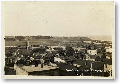
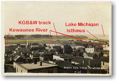
A postcard provides a bird's eye view of Kewaunee.
The town of Kewaunee, eastern terminus of the Green Bay Route, is in the foreground of this 1911 postcard. The view looks to the north. Lake Michigan is in the background on the right side of the photo. The Kewaunee River lies directly behind the city and extends across the entire width of the postcard view.
The KG&B tracks follow the Kewaunee River from Casco Junction to Kewaunee. As the railroad approached Kewaunee's harbor the tracks swung a little north of the river and then ended in a yard located on an isthmus of land separating the Kewaunee River from Lake Michigan. The Green Bay Route's two car ferry slips were located on the river side of this isthmus and a permanent channel was dredged on the south side of the isthmus (off of the right side of the photo) to permit year-round entrance of the ferry boats.

Postcard, 1911.

|
[ Top of This Page ] The Green
Bay Route is maintained by Mark
Mathu. |
|