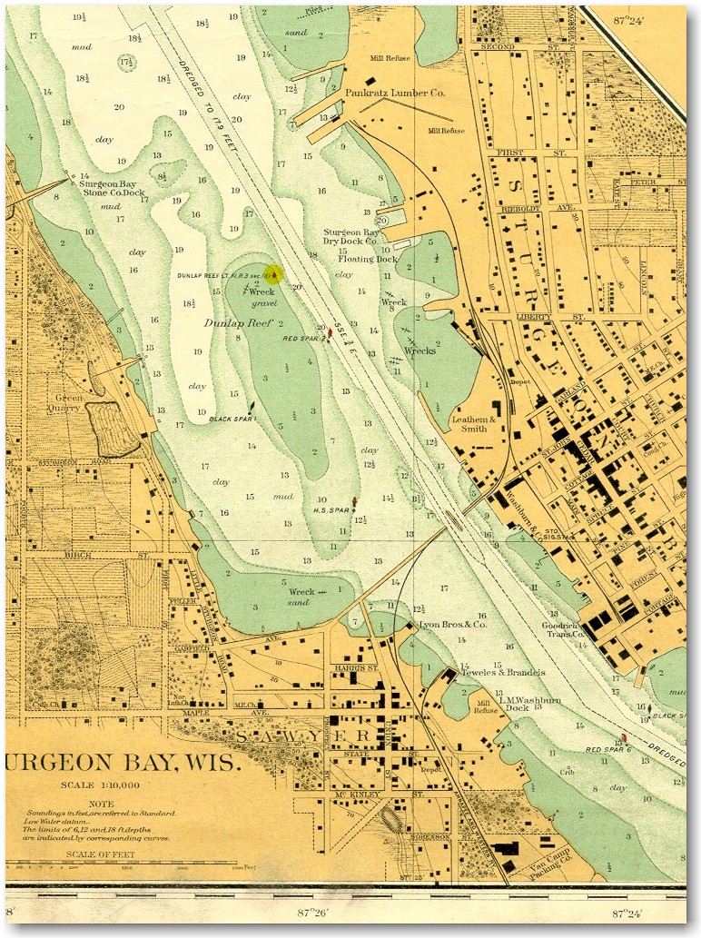
This map was issued May 27, 1925 by the U.S. War Department.
Although this map was intended primarily for use as a navigational aid, it gives an excellent insight into the rail system in place in Sturgeon Bay at this time.
- An enlarged view of the swing span bridge, depot, and engine house from this map..
- 1963 aerial photos of Sturgeon Bay.
The title on this map reads: "War Department - Corps of Engineers - Survey of the Northern and Northwestern Lakes - Made In Obedience To Acts of Congress and orders of The Chief of Engineers, U.S. Army. Sturgeon Bay Canal and Harbor of Refuge, Lake Michigan. Issued May 27, 1925.
Thanks is due to Kris Olson for providing this map. It belonged to his great-uncle, who sailed on Lake Michigan.

|
[ Top of This Page ] The Green
Bay Route is maintained by Mark
Mathu. |
|